

Tani jeni duke ndjekur
Gabim duke ndjekur përdoruesin.
Ky përdorues nuk lejon përdoruesit për ta ndjekur atë.
Ju jeni ndjekës i këtij përdoruesi.
Plani juaj i anëtarësimit lejon vetëm 0 ndjekje. Përmirësoni planin këtu.
U anulua me sukses
Gabim duke çndjekur përdoruesin.
Ju e keni rekomanduar përdoruesin me sukses
Gabim në rekomandimin e përdoruesit.
Diçka shkoi keq. Rifresko faqen dhe provo sërish.
Emaili u verifikua me sukses.

lahore,
pakistan
Aktualisht është 1:50 m.d. këtu
U bashkua korrik 13, 2017
0 Rekomanadimet
Muneeb A.
@MUNEEBAAMIR
0,0
0,0
0%
0%
lahore,
pakistan
Asnjë
Punët e Plotësuara
Asnjë
Brenda Buxhetit
Asnjë
Në Kohë
Asnjë
Shpeshtësia e Rimarrjes në Punë
Geospatial Expert
Kontaktoni Muneeb A. për punën tuaj
Identifikohu për të diskutuar çdo detaj gjatë bisedës.
Portofol
Portofol


Preparation of Digital Elevation Model
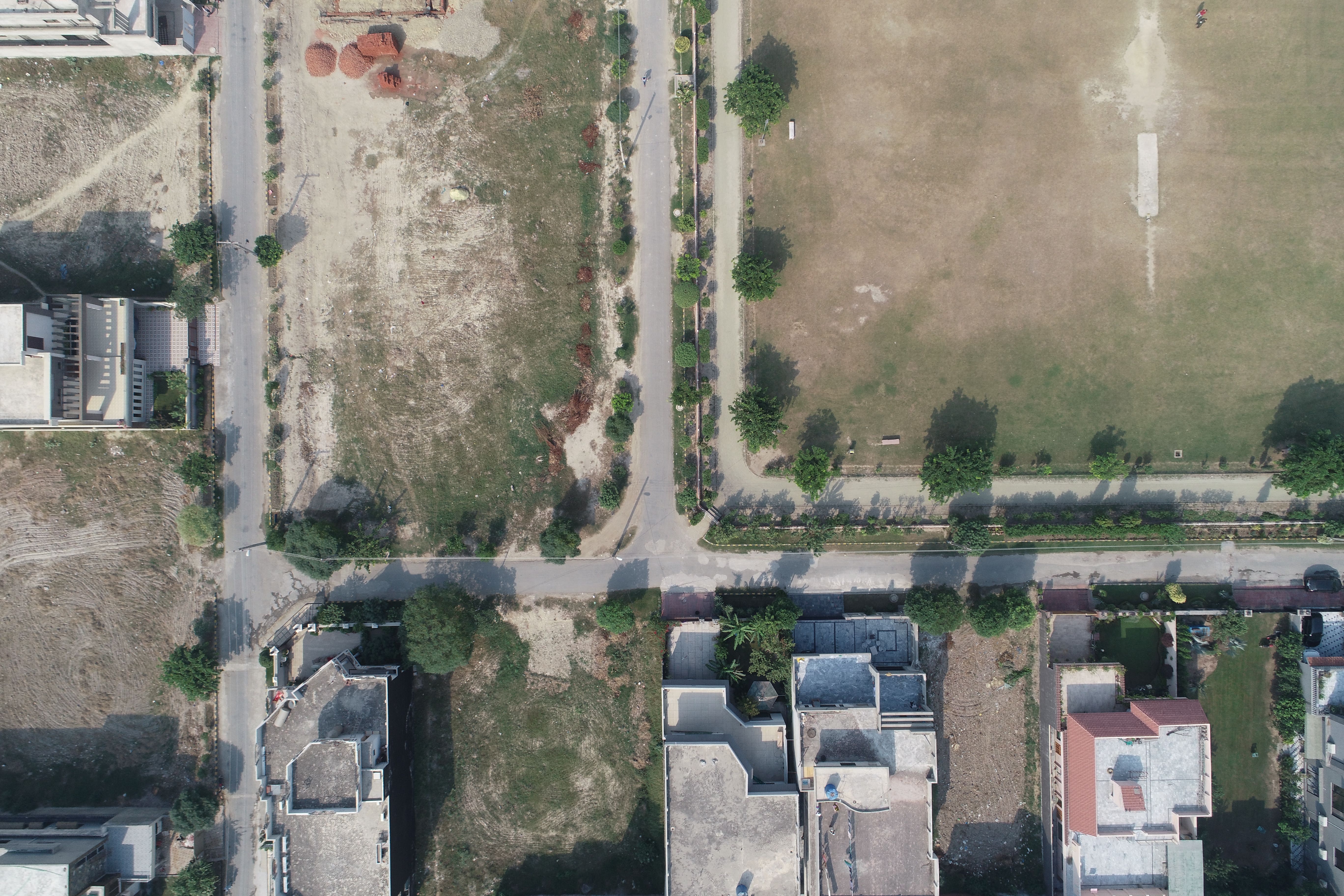

Drone Mapping

Drone Mapping

Drone Mapping
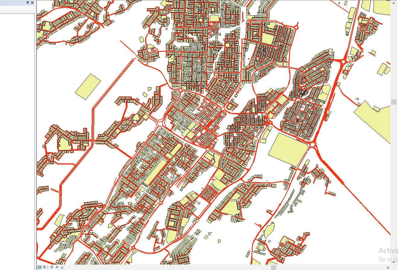

CAD to SHP Files

CAD to SHP Files
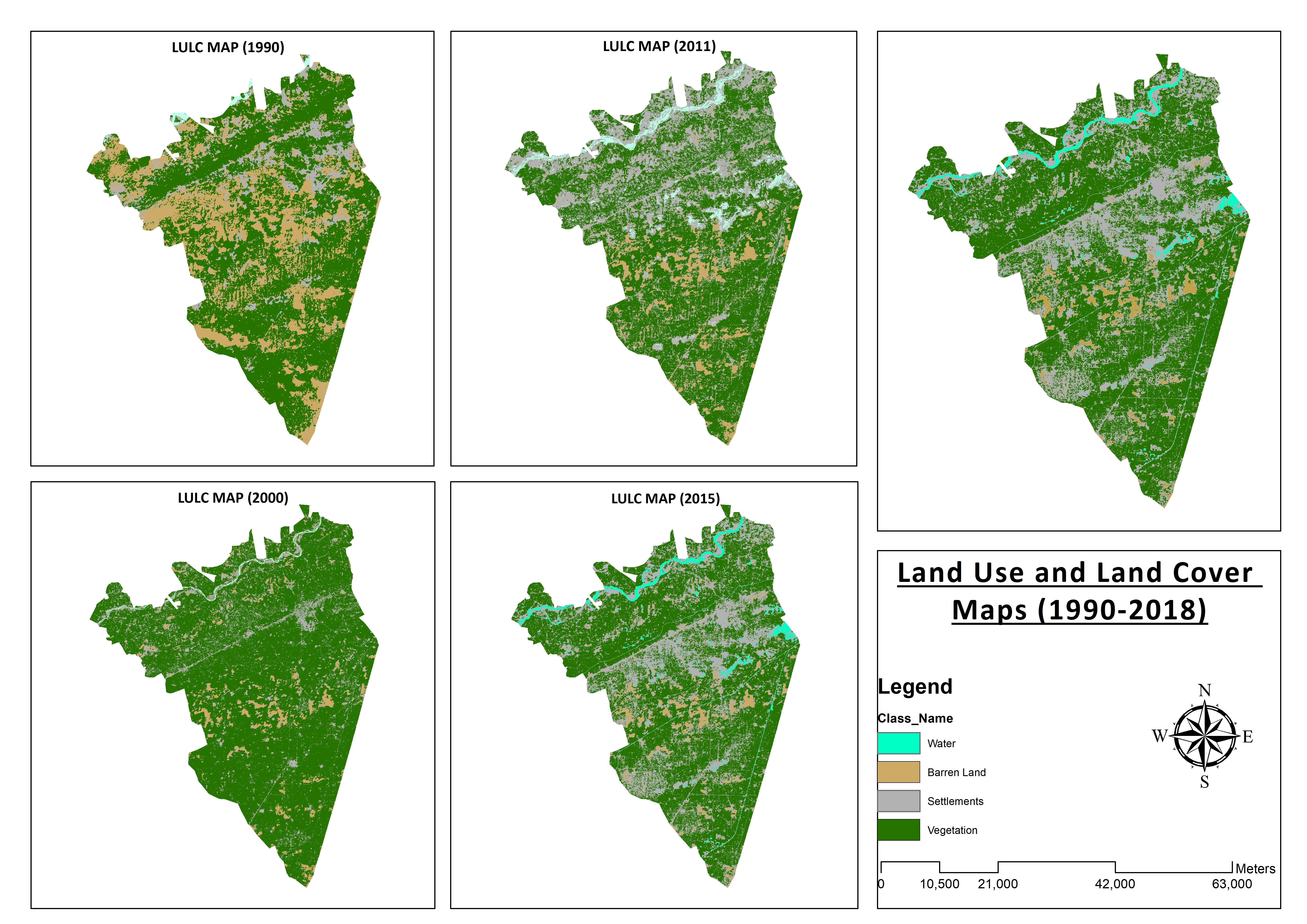

Land Use and Land Cover Maps
Preparation of Digital Elevation Model
Drone Mapping
Drone Mapping
Drone Mapping
CAD to SHP Files
CAD to SHP Files
Land Use and Land Cover Maps
Vlerësimet
Ndryshimet u ruajtën
Asnjë vlerësim këtu!
Përvoja
Remote Sensing and GIS Analyst
sht 2018 - tet 2019 (1 year, 1 month)
Developed, integrated and Implemented GIS and Geodesy based Topographic Survey Plans under different Hydro-Power Projects in Northern Pakistan, Extension of Canal Projects to increase its capacity in Sindh-Balochistan, Analysis of Suitable Site Selection for different development sites by using Drone for Aerial Mapping and their detailed pre-feasibility studies with different softwares, to analyse and interpret spatial data to produce interacting Maps and Reports while ensuring quality control.
Research Associate GIS
tet 2015 - tet 2018 (3 years)
Deployed GIS-based system under Urban Immovable Property Tax (UIPT) for Punjab Excise & Taxation Department. Provided comprehensive support in creating the system while take advantage of software suites like ArcGIS Suite and ERDAS Imagine. Prepared communicating maps to help surveyors in Analyzing geo-spatial data to verify it during ground truthing. Created shapefiles to merge topographical data with external data through layering process.
Arsimi
Master of Philosophy in Geographic Information System
(2 years)
Bachelors in Geographic Information System
(4 years)
Kualifikimet
MS-Office
TEVTA
2017
MS-Office Certification in MS-Word, Excel and Power Point.
Botime
Analysis of Flood Damage Assessment through Different Satellite Datasets in Southern Punjab,Pakistan
International Journal of Innovations in Science & Technology
RS and GIS techniques can achieve the objectives and significant analyses through visual interpretations. These techniques are also used to identify the flood affected regions. The study site was examined by applying supervised classification determining that 16900.96 Hectors of agriculture land was damaged while Sparse Riverine Forest had the area 44.52 hectors. The damaged built-up area was 1805.78 Hectors.
Estimation of Net Rice Production by Remote Sensing and Multi Source Datasets
Sarhad Journal Of Agriculture
Estimation of net crop production before harvest enables agronomists and decision makers to determine the volume of grain precisely. Yield estimation is one of the challenging tasks which is significant to evaluate accurately for farmers. This research was conducted in eastern Punjab Pakistan by incorporating yield/area as reported by Crop Reporting Service Department along with open source satellite datasets.
Kontaktoni Muneeb A. për punën tuaj
Identifikohu për të diskutuar çdo detaj gjatë bisedës.
Verifikimet
Aftësitë më të mira
Kërko punonjës të pavarur të ngjashëm
Shfleto ekspozita të ngjashme
Ftesa u dërgua me sukses!
Faleminderit! Ne ju kemi dërguar me email një lidhje për të kërkuar kredinë tuaj falas.
Ndodhi një gabim gjatë dërgimit të email-it tuaj. Ju lutemi provoni përsëri.
Kopja te kujtesa e fragmenteve nuk u krye, provo sërish pasi të kesh përshtatur lejet.
U kopjua në tabelë
Po ngarkohet shikimi paraprak
Leja u dha për Geolocation.
Seanca e hyrjes ka skaduar dhe ke dalë. Hyr sërish.